Advanced Land Surveying & Civil Design Services
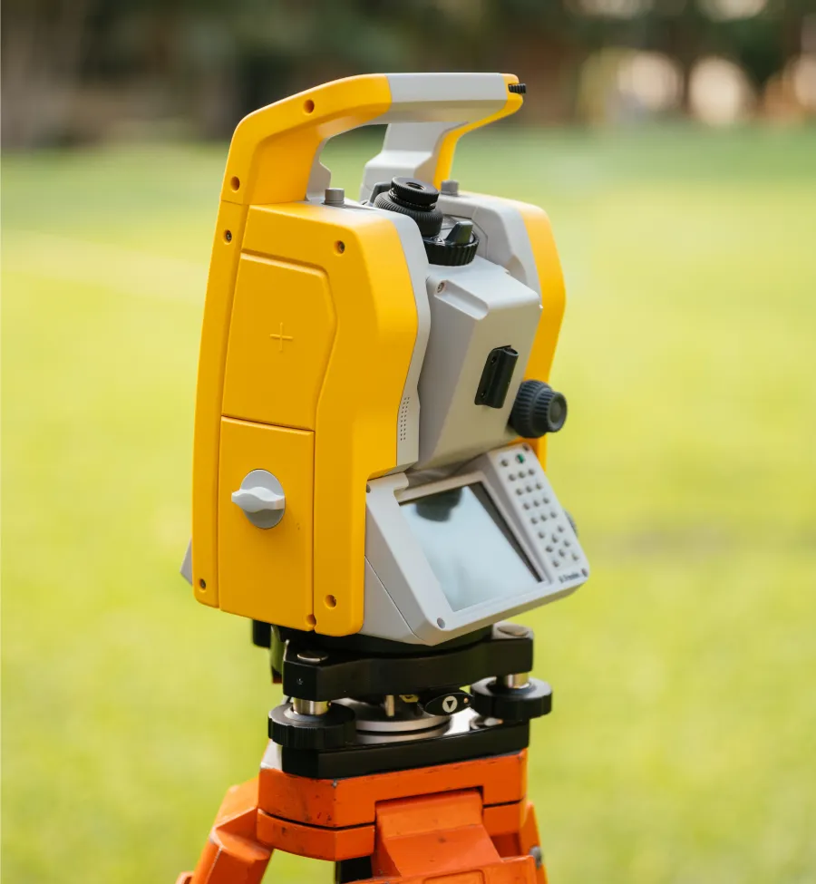
From complex solar plant layouts to residential JDA scheme approvals, we utilize state-of-the-art Pentax Total Stations and DGPS technology to deliver millimeter-level precision for every project.
Rapid deployment for boundary demarcation and topographic data collection.
500+ Projects Delivered
Our commitment to accuracy, speed, and regulatory compliance has earned us the trust of developers and engineers across Rajasthan.
We Combine Advanced Surveying Technology, Regulatory Expertise, and Dedicated Support to Ensure Your Project’s Success.
Total Station & DGPS Survey
High-precision mapping using advanced Pentax instruments for infrastructure, road alignment, and construction layout.
Contour & Topographic Mapping
Detailed vertical relief analysis to determine land slope, drainage patterns, and grading requirements for architects.
Accurate plot marking to resolve property disputes and define clear ownership lines using RTK satellite data.
Expert preparation of subdivision maps and scheme documents fully compliant with Jodhpur Development Authority regulations.
Specialized pile marking and coordinate calculations for maximizing efficiency in large-scale solar power plants.
Comprehensive digital surveys for agricultural land, revenue records, and road network planning.
Architectural Design (2D/3D)
Custom 2D floor plans and 3D elevation models that turn your raw land survey into a buildable vision.
Strategic planning for gardens, hardscapes, and outdoor environments that work in harmony with the natural terrain.
Color & Exterior Consultation
Professional advice on exterior aesthetics, material selection, and color palettes for new constructions.
How Our Dedicated Approach Works for Your Success
From initial consultation to final AutoCAD delivery, we follow a rigorous workflow to ensure data accuracy and regulatory compliance.
Consultation & Planning
We begin by analyzing your project requirements, whether it’s a simple plot demarcation or a complex solar plant layout, to determine the best surveying method.
Field Survey & Data Capture
Our licensed surveyors deploy to your site using Pentax Total Stations and RTK DGPS technology to capture millimeter-accurate ground data rapidly.
Processing & Delivery
We process raw data into detailed contour maps, boundary plans, or JDA-compliant scheme drawings, delivered to you in both digital (AutoCAD) and hard-copy formats.